Data Landscapes - Coming soon
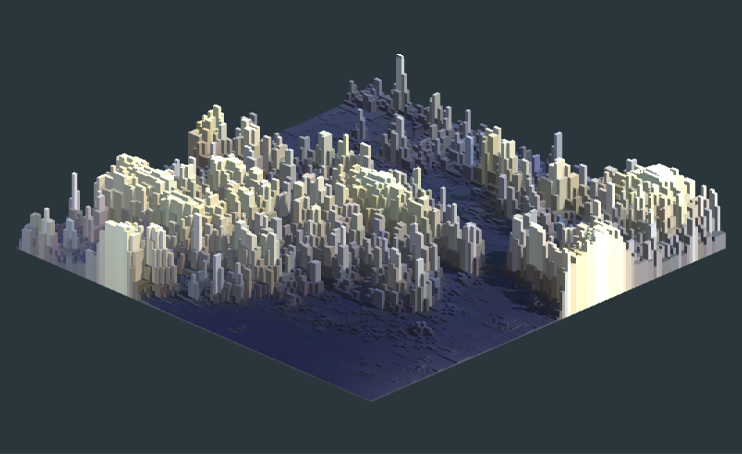
Currently in the making: Data Landscapes in Unity 3D. The data shown above is crowdsourced data about light pollution in England from the Globe at Night project . As the recordings are unequally distributed, the datapoints are interpolated on a 2000 x 2000 meter grid. The interpolated image is taken into Unity 3d where a grid of cubes is positioned along the z-axis based on the extracted pixel value. Stay posted for further developments!
subscribe to the tag via RSS
« Can we use Machine Learning to predict building functions?